Company Blog

Posts Tagged ‘obama’

The Obama Stimulus Package, State by State

February 10th, 2009 by George Maasry

The “American Recovery and Reinvestment Plan1,” as christened by President Obama, is meant to channel funds into areas critical to both the short- and long-term health of the US economy. Amidst online discussions of the plan, I came across a series of interesting articles on National Public Radio’s blog, in a section dedicated to economics called “Planet Money.”
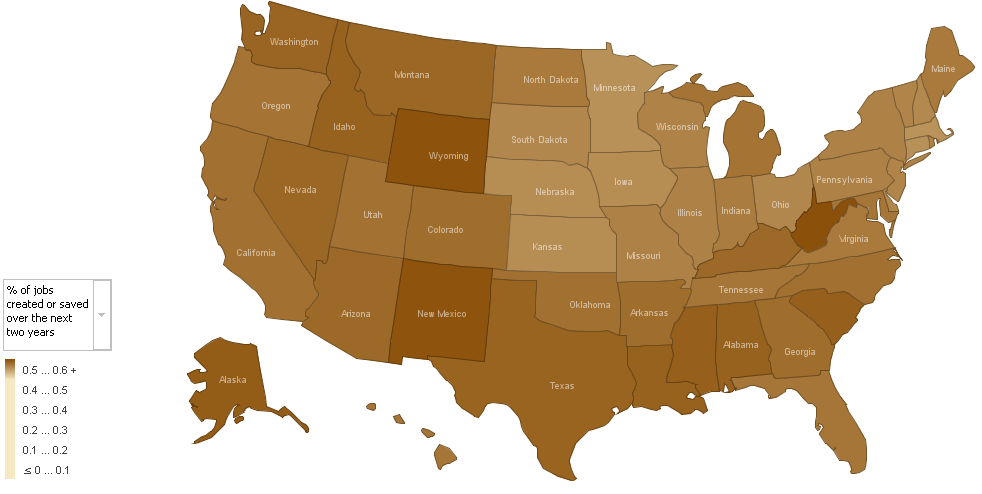
2D Map of Stimulus Package Effects by State (by Alan Cordova) These articles, authored by Alan Cordova2, analyze five elements of the stimulus package, based on estimates released by the White House3 last week. Mr. Cordova did a bit of data crunching with other US-government datasets, which I’ve emulated (household counts and employment figures from the Census Bureau)4, and produced some flat maps to
Alan Cordova’s map on Job Creation - click to enlarge

show which states would be most affected by each part of the stimulus package. He used IBM’s online visualization generator5, “Many Eyes,” to create the maps; incidentally, Many Eyes is part of what IBM calls its “Collaborative User Experience” project, and is a nifty interface to create some simple, incisive visualizations. But I digress.

Mr. Cordova’s post piqued my curiosity, and gave me a hankering to actually interact with the numbers myself; so, I reproduced his data and imported it into UUorld. To get spending numbers for individual states, I drew from the memo released by White House economic advisor Brian Deese last week. You can find that memo here.

The memo breaks benefits into five areas, in accordance with new programs; I thought I’d use the same. At first I played around with the sensitivity and ground-level values in UUorld for a bit so that each variable would display with a complete range of colors (I found it hard to differentiate between states in some of the brown 2D maps). In so doing, I came across an array of patterns I wasn’t aware of at first take:

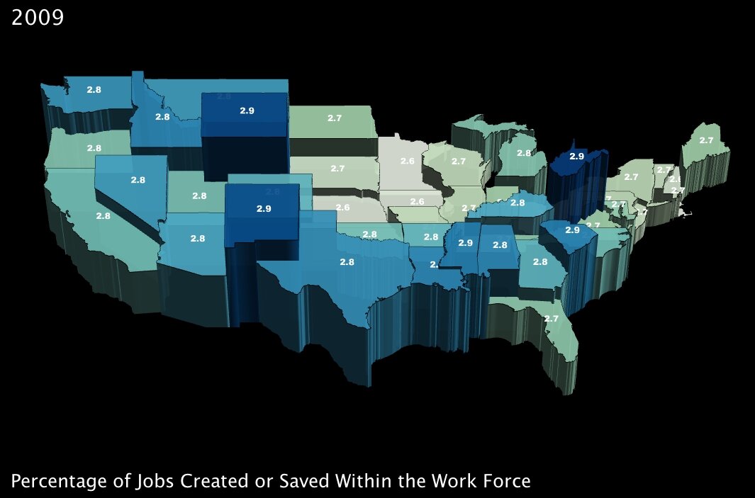
1. The number of jobs projected to be created or saved over the next two years, as a percentage of total employment in a state. (click images to enlarge)
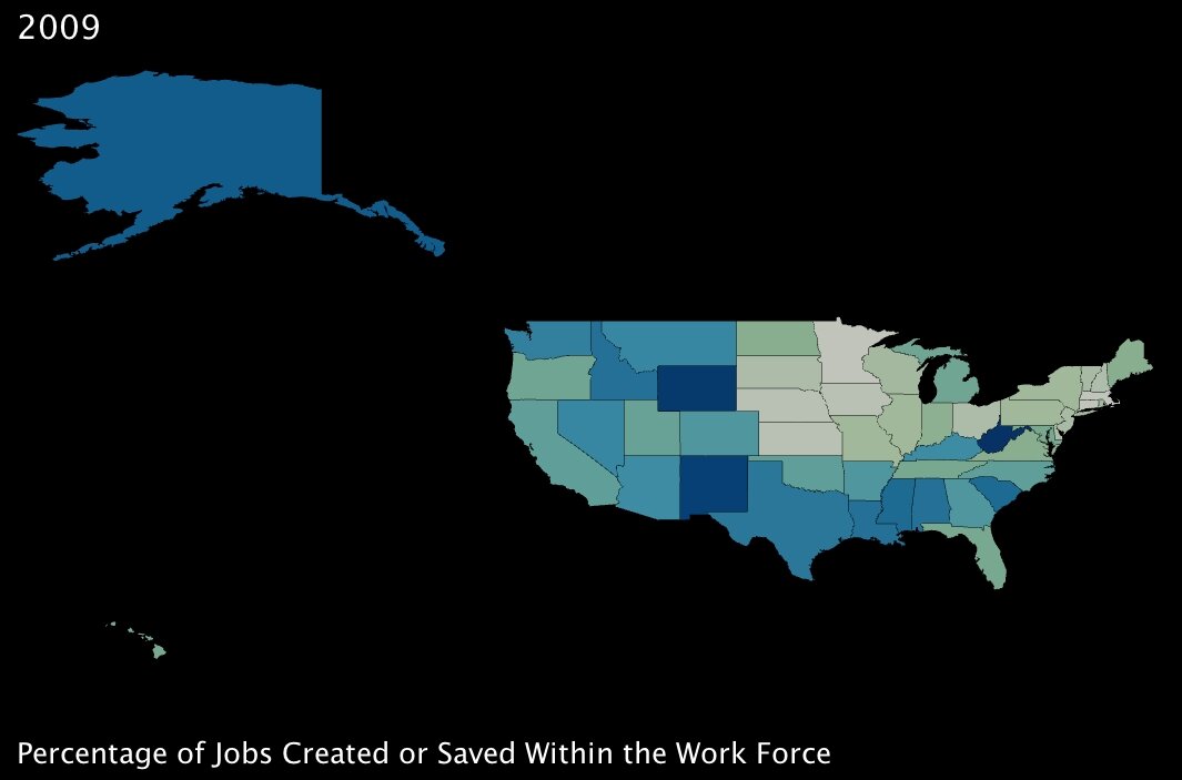
Percentage of Jobs Created or Saved with the Obama Stimulus Package, by State Percentage of Jobs Created or Saved with the Obama Stimulus Package, by State (3D)

2. The percentage of working-age adults eligible to receive a “Making Work Pay” tax cut of up to $1000. (click images to enlarge)
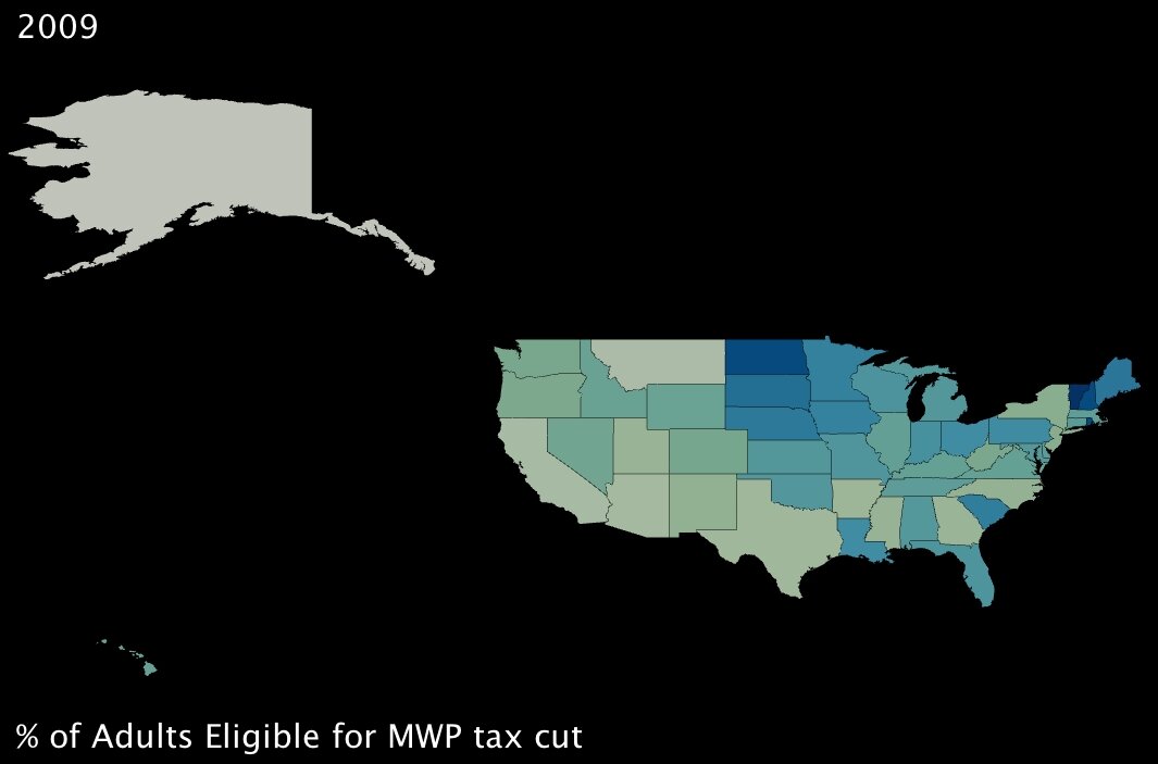
Percentage of Adults Eligible for the Making Work Pay tax cut, by State Percentage of Adults Eligible for the Making Work Pay tax cut, by State (3D)

These first two variables measure benefits that will, in theory, directly combat poverty. The first is of course job creation; the second translates to fiscal support for working adults who are below the poverty line — it’s a basic extension of the Earned Income Tax Credit6 (established under Ford, one of the rare domestic fiscal-policy creations that has garnered support from both political parties).

Interestingly, the two benefits seem to complement each other almost perfectly; in states where fewer jobs will be created by percentage, almost without exception, more families are supported by the tax credit. Also interestingly, a few southern states in particular — Lousiana, Alabama and South Carolina (and to an extent Kentucky) — will reap significant benefits from both parts of the program. These states are among the poorest in the Union (all in the bottom 10 by income)7, so at first glance, the added support seems well placed.

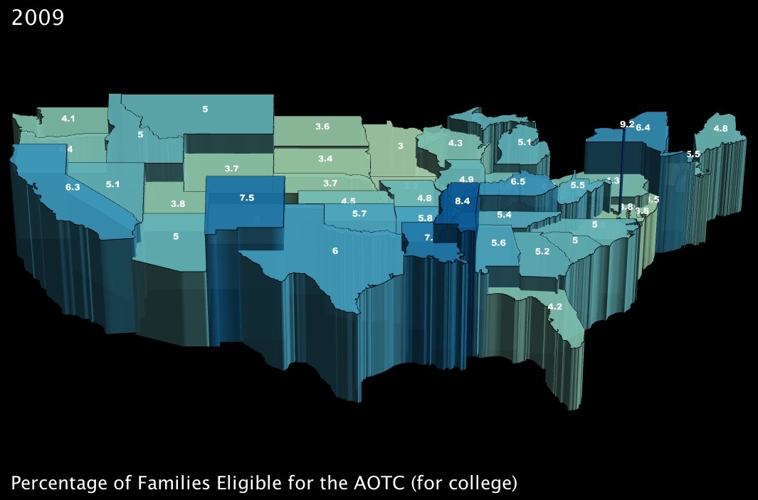
3. The percentage of families that will become eligible for government aid called the American Opportunity Tax Credit, which is geared specifically towards making college affordable for poorer families. (click images to enlarge)
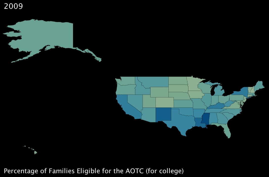
Percentage of Families Eligible for the American Opportunity Tax Credit, by State Percentage of Families Eligible for the American Opportunity Tax Credit, by State (3D)
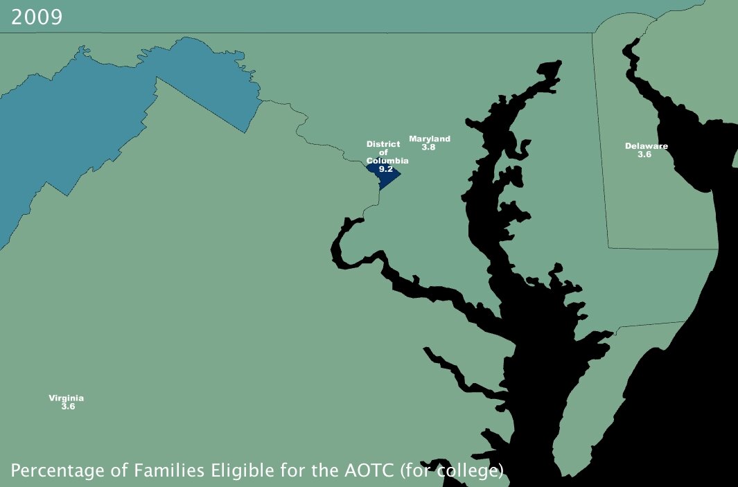
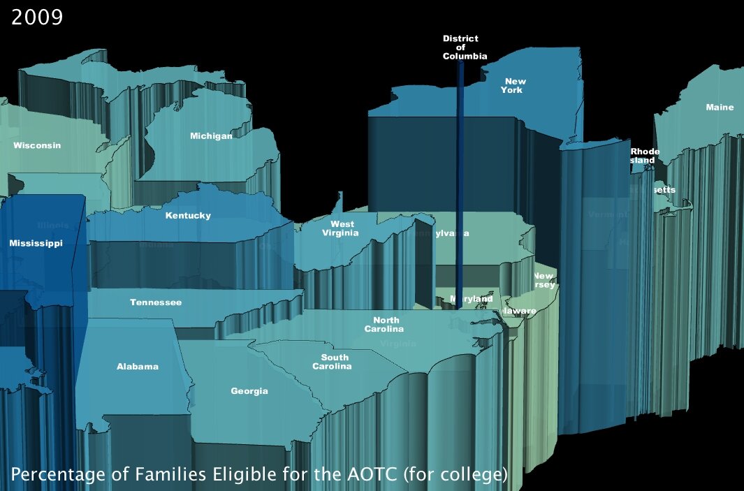
Percentage of Families Eligible for the American Opportunity Tax Credit, near Washington DC, by State Percentage of Families Eligible for the American Opportunity Tax Credit, near Washington DC, by State (3D)

The AOTC is meant to eliminate around two-thirds of college costs for families in need by furnishing a $4000 tax credit in exchange for 100 hours of community service performed by the candidate8.

It immediately jumped out at me that Washington DC, at 9.2% of families eligible, has about twice the number of possible candidates by percentage than most of the rest of the states in the Union. Conventional “wisdom” would hazard me to guess that this is because even though the District is not the poorest state — actually by per capita income it ranks as high as 16th7 — its population is severely divided economically. Note to self: look into statistics on that for a future post.

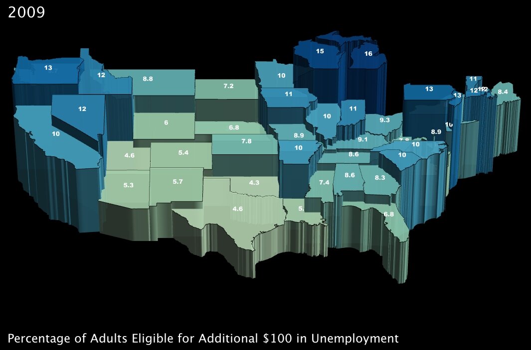
4. The percentage of working-age adults eligible to receive an additional $100 per month in unemployment insurance benefits. (click images to enlarge)
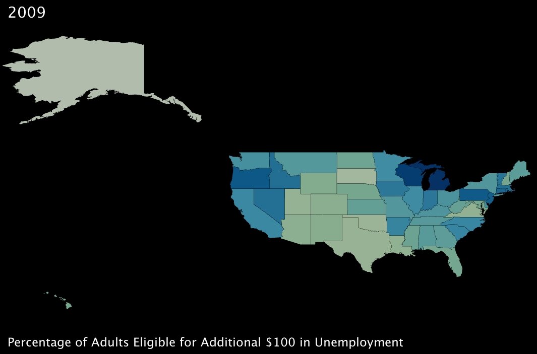
Percentage of Adults Eligible for $100 in Additional Unemployment Insurance, by State Percentage of Adults Eligible for $100 in Additional Unemployment Insurance, by State (3D)

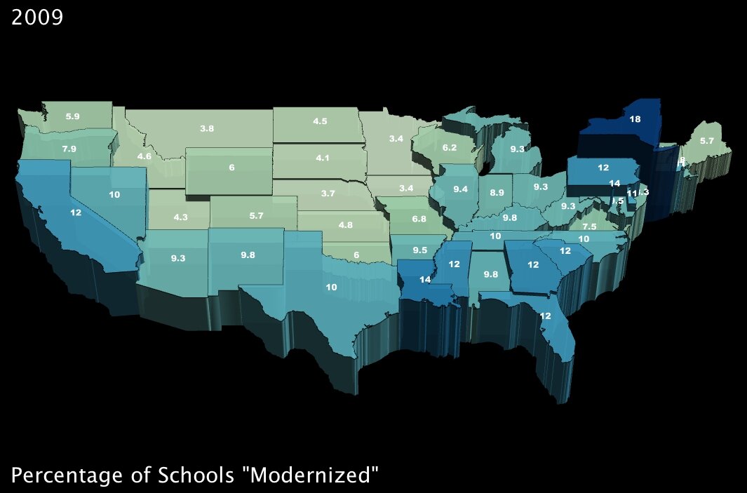
5. The percentage of schools that will undergo so-called “modernization.” (click images to enlarge)
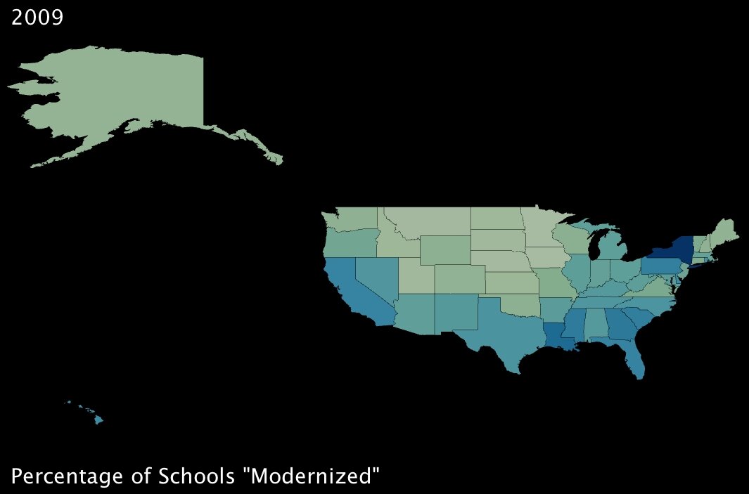
Percentage of Schools that will Undergo Modernization, by State Percentage of Schools that will Undergo Modernization, by State (3D)

Between these two measures, again it looks like benefits are well distributed around the country. While the additional unemployment credit will have greater effect in the northern states, it seems that southern states will benefit more from the school “modernization” project9 encapsulated within the stimulus plan.

When I started working with this data, my intention was to determine whether certain states were favored by the stimulus package (by measure of these variables, anyway). As it turned out, interestingly, the benefits seem to be more or less evenly distributed across the country … and while that may be a positive sign for the plan itself, it doesn’t do much to answer my question.

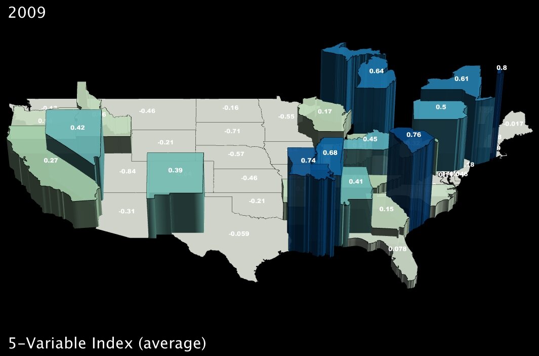
To dig a bit deeper, I took standard deviations and calculated z-scores10 for all five variables; then I created a new index variable by taking the average z-score for each state. Here are the results:
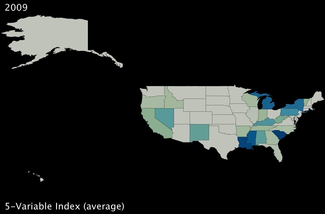
5-Variable Index (average z-score) 5-Variable Index (average z-score, in 3D)

The states in darker blue (and elevated in the second image) are the ones most positively affected, in the aggregate, by the five benefits of the stimulus package as originally delineated by the Deese memo.

It bears noting that Alaska ranks dead last, receiving the fewest benefits on average as measured by our given variables. However, it would be hard to argue that Obama is using the stimulus package to play favorites, at least on a state-wide level, given that his home state of Hawaii is quite far down the list as well (about two-thirds of the states fare better than Hawaii using this index).
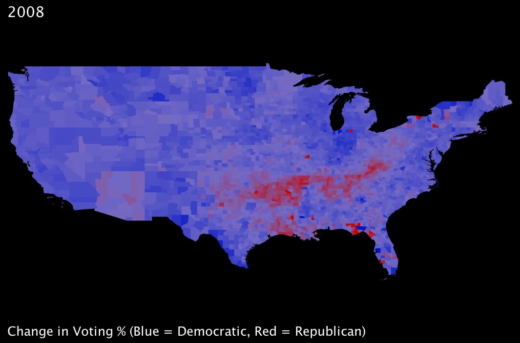
2008 Election - Change in Voting Percentages from Republican to Democrat Back during the immediate aftermath of the election, I looked at a range of statistics comparing voting trends — and my colleagues and I wrote some blog posts about those trends. Most notable, to my mind, is that almost without exception the country voted more democratically — that is, more in favor of Obama — than it had four years prior; this held true for even most states that are typically staunchly Republican. While the state may still have gone to John McCain in 2008, the overall

percentage of Democratic votes often dramatically increased from the Bush-Kerry election of 2004. The one exception to this was a strong tendency towards more Republican voting within a band spanning one of the poorest parts of the country: namely, the mouth of the Mississippi River in Mississippi and Louisiana, stretching up through Arkansas, and across Tennessee into Kentucky and West Virginia.

As I was familiar with this trend, I was surprised to note that the stimulus-plan index I created seems to show those same states are for the most part going to benefit proportionally more than many of their peers. Somewhat ironic, perhaps … or could the stimulus plan intentionally favor those constituents with whom Obama is currently least popular? To assert the numerical validity of that assumption, I pitted state-level election results (percentage of the vote won by the Democrats) against the 5-variable index by testing for statistical correlation11. The result was a correlation coefficient of 0.166, meaning that if anything there is a slight tendency for those states that voted for Obama to benefit more from the plan.

While 0.166 is not a strong correlation indicator either way, it does represent the strength of all five variables, averaged. As I had already found out, the benefits of each part of the plan are spread across the country in different proportions. Thus, I also tested for correlation between voting results and the 5 variables individually:

ALL. Five-Variable Index and % of 2008 Obama Votes: Correlation Coefficient = 0.1658 [small positive correlation]
1. Job Creation and % of 2008 Obama Votes: Correlation Coefficient = -0.6336 [large negative correlation]
2. Adults with MWP and % of 2008 Obama Votes: Correlation Coefficient = 0.1162 [small positive correlation]
3. Families with AOTC and % of 2008 Obama Votes: Correlation Coefficient = 0.1240 [small positive correlation]
4. $100 Benefits and % of 2008 Obama Votes: Correlation Coefficient = 0.3741 [positive correlation]
5. Schools Modernization and % of 2008 Obama Votes: Correlation Coefficient = 0.3721 [positive correlation]

This seems to indicate that the job creation forecasted by the White House tends strongly to states that voted against Obama. What the exact measures are to be taken to create those jobs is somewhat unclear, but that Republican-voting states are the predicted beneficiaries is striking.

Of course, correlation is not at all the same thing as causation. I remain wary that the demographic and economic differences that render certain parts of the country susceptible to one element of the stimulus package may be unrelated to whatever factors underpin ideological tendencies in a given direction.

As always, UUorld has helped me explore my questions, answer them, and then find many more.


Footnotes:

1. Wikipedia America Recovery and Reinvestment Plan.
2. Alan Cordova is a writer for “Planet Money” at National Public Radio. .
3. Boston Herald. “White House estimates new jobs in stimulus plan” by the Associated Press.
4. American Community Survey. The US Census Bureau’s 2006 tally of households by state; and American Community Survey. The US Census Bureau’s 2006 count of total employed adults by state.
5. research group. Many Eyes online data visualization tool.
6. Internal Revenue Service. Earned Income Tax Credit definition, questions and answers.
7. Wikipedia States of the US by Income.
8. . American Opportunity Tax Credit - Definition and Overview.
9. National Clearinghouse for Educational Facilities. Federal funding stimulus for school facilities: description and comparison of bills.
10. Wikipedia Standard score. Standard deviations were calculated like this: The differences between each value and the mean value are squared, summed, and then divided by the total number of measurements.
11. .

Where Obama Won — ‘08 Election County Analysis

November 13th, 2008 by Zach Wilson

Note: We gathered this data from major media outlets as they posted it, and it is not necessarily reflective of the most current tabulation. For the most recent and official data we suggest Dave Leip’s Election Atlas. Any of his data can easily be imported into our software.

http://www.uselectionatlas.com

Also, please note that what follows is a somewhat detailed handling of patterns in election data. For a more general overview you may want to scroll down to the next couple of posts. If you are going to skip down the page, you may want to quickly look at the last four images of this post anyway because Obama’s victory in Indiana, shown there, is a real standout among the many images that follow.

A prominent aspect of US election geography is that most urban areas favor Democrats and most rural areas favor Republicans. This past November 4th, while more overall counties voted Republican, Obama won because most of the most populated counties voted for him. We can see this pattern in the two images below. Flat counties in dark red are McCain victories, while all counties rising from the map are Obama victories, and the tallest and most blue are the places where Obama won the greatest percentage of the vote. With the purely color-coded map it is obvious how many more counties preferred McCain — all of the dark red ones. In the second image, it is much easier to see which areas favored Obama, and to what extent.

Arguably, a more interesting detail of the recent election is how, or rather where, Obama won that Kerry didn’t. We can begin to see where Obama gained votes by looking at voting trends from 2004 to 2008 in contrast with voting trends from 2000 to 2004. The images below use color to show the rate of change in the percentage of the vote going to the Democrat candidate. During each time period, blue counties have an increasing percentage of the vote leaning to Democrats, and in red counties the Democrat percentage is decreasing (which is to say red indicates an increase in Republican preference).

The image below shows that from 2000 to 2004 much of the Plains states, the South, and Utah, and Texas tended more Republican. In this case, blue counties are those that voted in a greater percentage for Kerry than they did for Gore.

Most of the next image down is blue, showing that most counties favored Obama against McCain to a greater extent than they had favored Kerry against Bush. The red counties preferred McCain more than they preferred Bush relative to their respective rivals. A band of counties stands out running from the Appalachians into Arkansas, also part of the panhandle of Florida, and western Louisiana. In addition we can see McCain’s home-state advantage — Arizona leaned slightly Republican this election in contrast with neighboring states.

We can extend the analysis further by looking more closely at a few regions and by adding another variable to the analysis. In the following images, colors will follow the same pattern as in the last two images, with red indicating an increase in the percentage vote for Republicans and blue as an increase in the percentage vote for Democrats. In addition height will show whether or not a county voted more than %50 for the running Democrat. All flat counties were Republican victories and all counties above the map were Democrat victories.

Specifically, in both of the next two images, color indicates the direction of change from 2004 to 2008, but in the first image, the counties above the map are counties Kerry won, and in the second image the counties above the map are counties Obama won. These settings mean that anywhere above the map in the first image and flat on the second image is a county that Obama lost. Obama’s relative losses are always red. By contrast, anywhere in blue, and above the map in the second image, but flat in the first image, is a county Obama added to the Democrat coalition.

Maybe you can see that Obama lost counties in parts of Florida and West Virginia and Kentucky and gained in North Carolina, Indiana, and other parts of Florida.  Don’t strain your eyes too much though, as we’ll take a closer look right away; first the nationwide images…

Looking more closely at the West we can see that Obama did broadly better than Kerry (shown by blue) whether or not the county was in aggregate a Democrat victory, and as noted earlier, McCain did slightly better than Bush in Arizona.

Moving east and focusing on the areas of Texas and West Louisiana where the Democrat share of the vote declined (in red), we can see that very few of these counties were won by Kerry because these areas are flat. By contrast some counties in Arkansas were won by Kerry (shown as elevation) but appear in red, which suggests Obama may have lost some of these counties that Kerry had won.

Looking from the west at Arkansas and into the Appalachians, we can see through a comparison of the next two images that some red counties switched from a majority favoring Kerry to a majority favoring McCain. In the first image we have counties above the map if Kerry won these counties. In the second image the counties above the map are counties Obama won. As a result, we know that Obama lost some counties that Kerry had won in this red band, but at the same time much of this band was Republican leaning to begin with and only became more so.

Looking from the south, we can see that Obama also lost a few counties that Kerry had won in Florida. In the second image, Jefferson Davis County stands out as an example of where Obama retained a majority of the vote despite winning a lesser share than Kerry. We can also see in this region that Obama increased the percentage vote won in places that already voted heavily Democrat.

We’ll now turn to examine a few states where Obama won new counties and earned these state’s electoral votes as a result. For example, this was the case in Florida. Obama lost counties in the panhandle but made up ground by winning other counties Kerry had not, a few of them being panhandle counties neighboring those he lost. The colors in the first image show the trend in voting from 2000 to 2004. In the second and third images, color indicates the trend direction from 2004 to 2008, and height shows, where Kerry won, and then where Obama won. Given the high population in Miami-Dade County (in the far south east and poping off the map in the final image), we can be sure it was important for Obama’s victory in the state, though the general blue trend of most counties is also notable.

A quick look at trends in Ohio shows us that Kerry and Obama gained ground in rather different counties, split along an east-west divide. The first image is the trend for 2000 to 2004. The second image is the trend from 2004 to 2008.

In North Carolina, we can see the trends 2000 to 2004 and then 2004 to 2008, just as above, except in North Carolina Obama’s gains were more consistent, improving the Democrat margin in most counties, matched by Kerry’s fairly consistent losses shown in the first image.

These widespread gains tipped the balance to gain the state for Obama. Below, colors remain as in the most recent image, showing where Obama gained ground, and height shows first where Kerry earned a majority, then where Obama was able to nudge above %50 of the vote. You may have to look closely to count them because mainly the differences are small, but every county that nudges off the map in the second image is a place that helped secure North Carolina for Obama.

Last, but possibly most striking, we’ll look at Indiana. These four images follow the same pattern as the last four. First, the trend 2000 to 2004. Second, the trend 2004 to 2008. Third we use height to show those counties won by Kerry. Fourth we use height to show those counties won by Obama.

2008 Election Videos and Pictures

November 10th, 2008 by Willy Pell

We were very excited to get our hands on the new election data. The first thing we wanted to see was a video showing how voting patterns have changed from the 2000 Bush vs. Gore election through the 2004 Bush vs. Kerry election and to the 2008 Obama vs. McCain election. We were expecting a dramatic shift:

County Height = % Democratic Votes
Bluer Color = higher % Democratic Votes
Redder Color = higher % Republican Votes
Whiter Color = even

County Height = % Republican Votes
Bluer Color = higher % Democratic Votes
Redder Color = higher % Republican Votes
Whiter Color = even

There really has only been a slightly perceptible shift in voting patterns over the last 8 years and 3 elections. I had to speed up the clock dramatically just to make the change visible.

The next two images are colored by rate of change from one party to another.

Blue = Movement from Republican to Democrat
Red = Movement from Democrat to Republican
White = No change
Height = % Republican votes

Rate of change between the 2000 Bush vs. Gore Election and the 2004 Bush vs. Kerry Election:

Rate of Change between the 2004 Bush vs. Kerry Election and the 2008 Obama vs. McCain Election:

Now we see a more dramatic shift. Barring a swathe of Southern and Appalachian counties which became more Republican, most of the counties either stayed the same or became more Democratic.

Election Results: County-Level Data and Maps

November 4th, 2008 by George Maasry

We’ve been preparing for a visual analysis of this year’s election results by practicing with 2000 and 2004 election data. Our objective was to see how demographic and economic trends compare with or amplify presidential voting patterns.

Click here to go directly to sample images.

The work has been exploratory more than anything, and though the images have been impressive, we have held back from drawing conclusions from this first assessment. We enjoyed exploring the data and building new tools for rescaling and connecting statistics, and now we are opening up the effort to other observers.

As a window into the work, we are posting a bundle of images that show poverty rate crossed with percentage of votes for Bush, Kerry, and Gore in a given county. A description of the methods can be found at the bottom of the sample images page.

We also have more than 60 other crossed variables available on our Data Portal. Look for the set tag “UUorld Election Package I.”